A marketing render and a planning visual serve opposite purposes. The first is designed to make a building appealing. The second is designed to let a decision-maker judge its impact honestly — and if it flatters, it damages the application's credibility, sometimes fatally.
Planning authorities, objectors, and inspectors have become considerably more sophisticated about this. A visual that cannot demonstrate how it was produced carries little weight.
What makes a view "verified"
A verified view — commonly called an Accurate Visual Representation, or AVR — is a photomontage produced by a documented, repeatable method that allows any reviewer to confirm the proposed building is shown in the correct position, at the correct size, from the correct viewpoint.
The essential components:
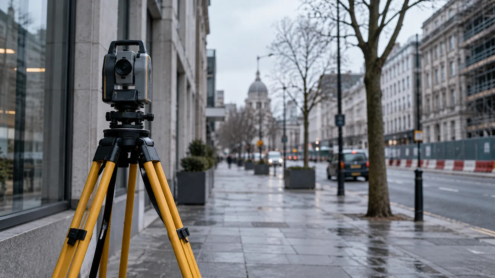
Surveyed viewpoint. The camera position is surveyed to the project's coordinate system, with its height above ground recorded. "Approximately from the corner of the square" is not a viewpoint.
Recorded camera data. Focal length, sensor size, height, bearing, and tilt, recorded at capture. These parameters are what allow the virtual camera to be matched.
Surveyed reference points in the photograph. Identifiable fixed features — building corners, lamp columns, kerb intersections — surveyed so the virtual camera can be aligned against them and the alignment demonstrated.
Correct model positioning. The proposal placed in the real-world coordinate system, at the correct level, on accurate topography.
A methodology statement. Documenting equipment, date, time, weather, survey method, software, and the verification process. This document is what turns an image into evidence.
AVR levels
UK practice commonly classifies verified views by how much information they convey:
AVR Level 0 — Location, size and position. A wireframe or simple massing shown in the photograph. Demonstrates where the proposal sits and how large it is, with no material or design information.
AVR Level 1 — Level 0 plus outline of the proposal. Adds the building's silhouette clearly, still without surface treatment.
AVR Level 2 — Level 1 plus a degree of visible detail. Fenestration pattern, articulation, and massing detail shown, typically in a neutral rendering, with materials indicated but not fully realized.
AVR Level 3 — Full photorealistic representation. Materials, reflections, and lighting fully rendered and matched to the photograph's conditions.
Levels 0 and 1 are frequently more useful in contested applications, precisely because they cannot be accused of flattering the design. A wireframe cannot be argued with about materials; it demonstrates massing and nothing else. Many authorities request them alongside higher-level views for exactly this reason.
Choosing viewpoints
Viewpoint selection is generally agreed with the local planning authority before capture, and objectors may propose additional views. Selection should cover:
- Key public vantage points — principal approach routes and gathering spaces
- Designated views and protected vistas where these apply
- Heritage settings — views from and towards listed buildings, conservation areas, and scheduled monuments
- Residential amenity viewpoints where overlooking or daylight is at issue
- Long-distance views where the proposal affects a skyline
- Worst-case views — the positions from which the proposal is most prominent
The last is the one applicants resist and should not. Omitting the worst view invites an objector to produce it, at which point the applicant's entire visual package is treated as selective.
Photography requirements
Base photography should be captured to a consistent, documented standard:
- A full-frame camera with a lens of known, fixed focal length; 50mm equivalent is common as it approximates natural perspective, though wider views may require documented alternatives
- Tripod-mounted at a recorded height, typically around eye level at 1.5–1.6 m
- Level camera, or recorded tilt
- Consistent season and foliage condition, with winter views usually required for vegetated settings since summer foliage conceals impact
- Clear conditions and even lighting; overcast is often preferable to strong directional sun
- Time and date recorded
- Original RAW files retained as evidence
Summer-only photography of a scheme screened by deciduous trees is a common and easily challenged omission.
Terrain and context accuracy
The proposal must sit on accurate ground. Sources include survey data, published terrain models, and photogrammetry or laser scan of the immediate context. Where the surrounding built form is included, its accuracy matters — neighbouring building heights taken from assumption rather than survey are a frequent source of challenge.
For heritage-sensitive settings, laser scanning the immediate context is increasingly standard, because it produces demonstrable geometric accuracy rather than assertion.
Townscape and visual impact assessment
Verified views usually accompany a Townscape and Visual Impact Assessment, prepared by a landscape or townscape specialist. The images are evidence within that assessment, not a substitute for it.
The relationship is important: the assessment reaches a judgment about magnitude and significance of effect, and the visuals must support that judgment transparently. Visuals that appear to contradict the written assessment are more damaging than no visuals at all.
Common failures
Unverifiable camera positions. No survey, no methodology, no reference points. The image cannot be checked and will be discounted.
Flattering treatment. Idealized weather, generous planting that does not yet exist, and an unusually appealing sky. Reviewers recognize it and discount the whole package.
Mature planting shown at day one. Proposed landscape should be shown at establishment as well as at maturity, with the years indicated.
Inconsistent lighting between photograph and render. Shadow direction that does not match the photograph is the fastest way to reveal that the montage was not properly matched.
Only favourable viewpoints. Discussed above; it is the most consequential error.
Missing methodology statement. Without it, an AVR is simply a render.
Supporting studies that accompany the visuals
Verified views rarely stand alone. A planning submission for a scheme of any prominence usually includes several related studies, and their consistency with the visuals matters.
Daylight and sunlight assessment to the relevant methodology, showing effects on neighbouring windows and amenity space.
Shadow studies at the standard reference dates, typically the equinoxes and solstices, shown hourly across the affected area.
Wind microclimate assessment for taller schemes, where pedestrian-level wind conditions are a material consideration.
Zone of theoretical visibility for schemes affecting a wider landscape, showing where the proposal could be seen from before viewpoints are selected.
Massing comparison against the existing condition and, where relevant, against what could be built under existing permissions or policy.
The consistency requirement is straightforward but frequently missed: the building shown in the visuals must be the building assessed in the studies and the building described in the drawings. Divergence between them — a scheme visualised at a marginally lower parapet than it is drawn — is the kind of discrepancy that objectors look for and that undermines an entire submission when found.
Working with the authority early
Pre-application engagement on visual matters saves more time than almost any other planning activity. Points worth agreeing before production:
- The viewpoint list, including any the authority or its conservation officer wants added
- The AVR level required at each viewpoint
- The season and foliage condition required
- The methodology, so it is not challenged after the work is done
- The format and scale at which images will be presented, including whether printed at a specified size for correct perspective
- Whether a third-party verification of the methodology is expected
Agreeing this list converts the visual package from a submission the authority may reject into one it has effectively specified. It also removes the most common source of delay, which is being asked for additional views after determination has started.
Frequently asked questions
How many views does an application need? Determined by scale, sensitivity, and pre-application discussion with the authority. A prominent scheme in a heritage setting may require fifteen or more; a modest proposal considerably fewer.
Can existing photography be reused? Only where camera data and viewpoint survey exist and the scene has not changed. Undocumented archive photography cannot support a verified view.
Do the same requirements apply outside the UK? The terminology differs, but the principle — demonstrable accuracy from documented viewpoints — is common to planning systems in Australia, Ireland, and many US jurisdictions with design review processes.
Related reading: What Actually Drives the Cost of Architectural Rendering · Real-Time vs Offline Rendering: Choosing by Purpose · Scan to BIM: Turning Point Clouds Into Usable Revit Models
Vantage CAD Services produces verified views, AVRs, and photomontages with full methodology documentation for planning submissions. Contact info@vantagecadservices.com or +1 (512) 543-0831.